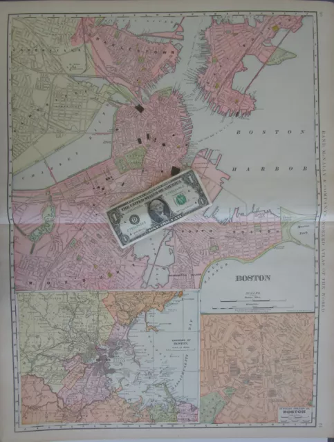
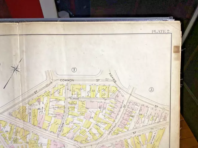
1901 Map CHARLESTOWN BOSTON MA Bromley Ward 5 Plate 2 Assessor VG framable color
Seller: mstgsh ✉️ (338) 100%,
Location: Medford, Massachusetts, US,
Ships to: US, BM, CA, GL, MX,
Item: 296045607744
1901 Map CHARLESTOWN BOSTON MA Bromley Ward 5 Plate 2 Assessor VG framable color. Ward 5 of the City of Boston, Charlestown, Massachusetts, in 1901, showing are area between Main, Common, Adams, City Square, Water Sts., and Warren Avenue. In Bromley's Atlas of 1901, this map is identified as Plate 16. Paper size 32.25" wide x 22.5" high Image size 30.25" wide x 20.5" high Bromley city maps were widely published around the turn of the 19th century, usually for purposes of making important public information readily available to the public and officials. Assessors and various other city officials (planners, fire and police forces, utility and service providers, etc.) thereby had critical information readily available. The information provided included a scale (1"=50'), a compass/North indicator, property parcel limits, parcel size and ownership, building footprints (red for masonry, yellow for wood frame), street frontage of lot, street name and addresses, roads, sidewalks, water and sewer mains, rail lines, larger building names, and tax block number. Streets include; Main, Common, Adams, Water, Warren Chelsea, Henley, Joiner, Hudson, Gray, Foss, Wapping, Chestnut, Winthrop, Putnam, Elmwood, Maudlin, Chamber, and Call St. Landmarks include; Charlestown Bidge. Boston Elevated Railway, Distillery, Sailor's Haven Mission, Fitchburg Railway Co., Carriage Wks, Wagon Wks, Livery, Stable, Bunker Hill Nat Bk, Roughen Hall, Park St Stables, Warren Institution for Savings, Boarding Stable, and National House.
- Condition: Very Good, suitable for framing. Clean and presentable with no markings (other than legible markups of 4 parcels). Fold in middle of map, as bound into the atlas. Two missing atlas tabs at side margins (outside image). About one dozen tiny pinholes scattered over the map (noticeable only upon close inspection, likely due to thumb pins), The maps are often damaged given the years of frequent use. This map however is very clean and nearly damage free, making it an ideal candidate for framing and presentation.The paper is backed with a fine textile reinforcement, resulting in a durable flexible sheet. Occasional bruises and soiling of edges well outside the image allows for a clean mounting.
- Date Range: 1900-1909
- Type: City Map
- US State: Massachusetts
- Format: Atlas Map
- Year: 1901
- Original/Reproduction: Antique Original
- Cartographer/Publisher: G W Bromley Co.
- City: Boston
- Country/Region: United States of America
PicClick Insights - 1901 Map CHARLESTOWN BOSTON MA Bromley Ward 5 Plate 2 Assessor VG framable color PicClick Exclusive
- Popularity - 1 watcher, 0.0 new watchers per day, 155 days for sale on eBay. Normal amount watching. 0 sold, 1 available.
- Best Price -
- Seller - 338+ items sold. 0% negative feedback. Great seller with very good positive feedback and over 50 ratings.
People Also Loved PicClick Exclusive

1901 Map CHARLESTOWN BOSTON MA Bromley Wards 3 & 5 Assessor VG framable color
$58.50 Buy It Now 27d 12h
1901 Map CHARLESTOWN BOSTON MA Bromley Ward Assessor VG framable color detailed
$67.50 Buy It Now 27d 11h
1901 Map CHARLESTOWN BOSTON MA Bromley Part of Ward 5 Assessor VG framable color
$67.50 Buy It Now 27d 12h
1883 Bromley Map BOSTON MA color VG Wards 6 & 7 Plate B North End & Waterfront
$112.50 Buy It Now 28d 6h
1916 Map CAMBRIDGE MA Bromley Part of Wards 1 & 2 Assessor VG framable Plate 10
$58.50 Buy It Now 27d 14h
MA 1891,1901 DATED BOSTON Map 3 on 1 Sheet City, Vicinity, Downtown CHARLESTOWN
$36.45 Buy It Now


